


Johnson Grade Cafeteria Voting District, Harrison County, West Virginia
About
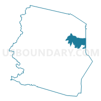
Outline

Summary
| Unique Area Identifier | 690782 |
| Name | Johnson Grade Cafeteria Voting District |
| County | Harrison County |
| State | West Virginia |
| Area (square miles) | 11.84 |
| Land Area (square miles) | 11.83 |
| Water Area (square miles) | 0.01 |
| % of Land Area | 99.93 |
| % of Water Area | 0.07 |
| Latitude of the Internal Point | 39.32339580 |
| Longtitude of the Internal Point | -80.25027130 |
Maps


Graphs
Select a template below for downloading or customizing gragh for Johnson Grade Cafeteria Voting District, Harrison County, West Virginia


Neighbors
Neighoring Voting District (by Name) Neighboring Voting District on the Map
- Voting District 1, Taylor County, WV
- All Saints Catholic Church Voting District, Harrison County, WV
- Bridgeport High Cafeteria Voting District, Harrison County, WV
- Bridgeport High Home Ec Rm Voting District, Harrison County, WV
- Christian Apostolic Church Voting District, Harrison County, WV
- Old Summit Park School Voting District, Harrison County, WV
- Saltwell Rd Church Voting District, Harrison County, WV
- Simpson Grade School Voting District, Harrison County, WV
- Spelter Fire Department Voting District, Harrison County, WV
Top 10 Neighboring County Subdivision (by Population) Neighboring County Subdivision on the Map
- Eastern district, Harrison County, WV (12,529)
- North Urban district, Harrison County, WV (11,045)
- Northern district, Harrison County, WV (10,741)
- Western district, Taylor County, WV (6,809)
Top 10 Neighboring Place (by Population) Neighboring Place on the Map
Top 10 Neighboring Unified School District (by Population) Neighboring Unified School District on the Map
Top 10 Neighboring State Legislative District Lower Chamber (by Population) Neighboring State Legislative District Lower Chamber on the Map
Top 10 Neighboring State Legislative District Upper Chamber (by Population) Neighboring State Legislative District Upper Chamber on the Map
Top 10 Neighboring 111th Congressional District (by Population) Neighboring 111th Congressional District on the Map
Top 10 Neighboring Census Tract (by Population) Neighboring Census Tract on the Map
- Census Tract 321.02, Harrison County, WV (6,386)
- Census Tract 308, Harrison County, WV (4,776)
- Census Tract 9647, Taylor County, WV (4,490)
- Census Tract 321.01, Harrison County, WV (3,672)
- Census Tract 320, Harrison County, WV (2,775)